
Photogrammetry · Drone · RTK GNSS
Drone photogrammetry: from the flight to a georeferenced 3D model.
Photogrammetry rebuilds an object in three dimensions from photographs. Combined with drones and control points measured by RTK GNSS, it produces 3D surveys accurate to 1 to 3 cm, from roofs to large areas.
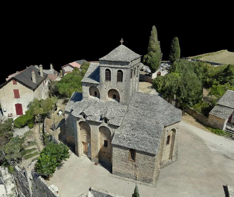
What is photogrammetry?
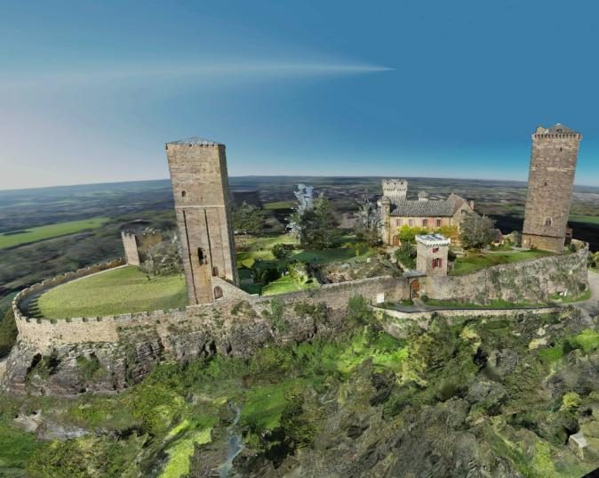
Photogrammetry is the technique of measuring an object from photographs. When the same point appears on several images taken from different angles, its position in space can be computed, just as our two eyes do. Repeated over millions of points and hundreds or thousands of photos, this computation produces a dense point cloud, then a photorealistic textured 3D mesh.
Modern 3D photogrammetry is fully digital: software automatically matches common points between images, computes the position of each shot and rebuilds the geometry. The quality of the result depends above all on the quality of the capture: photo resolution, overlap between images and georeferencing.
Why use a drone?
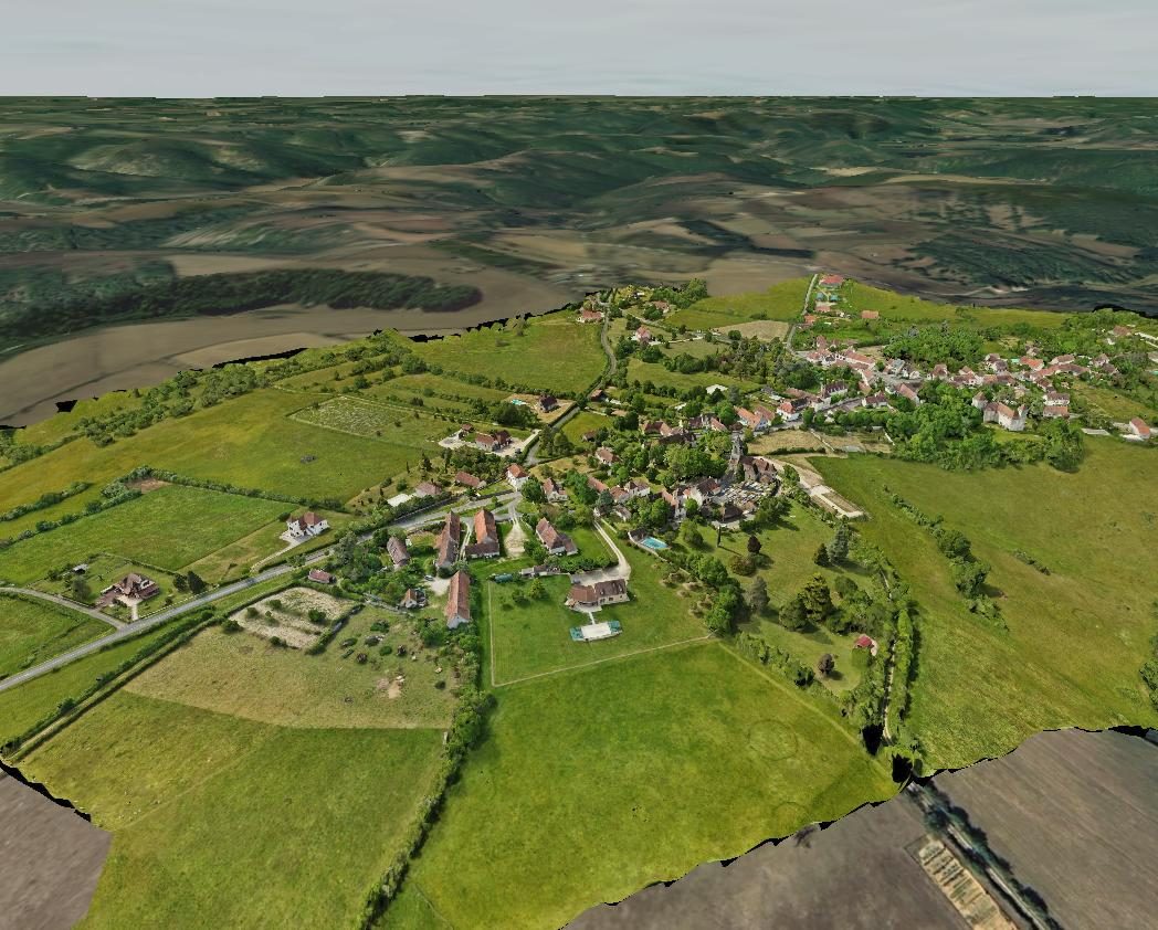
The drone puts the camera where it matters: above roofs, in front of high facades, around a bell tower, above a plot of land or an entire village. Drone photogrammetry avoids cherry pickers and scaffolding, covers large areas in a few flights and combines with ground photography for interiors and details.
For large areas, our flight plans are computed by SmartWaypoints, our flight planning platform: altitude follows the terrain for a consistent resolution, and flights can be repeated to monitor a site over time.
How accurate is it?
A photogrammetric model is only accurate if it is properly tied to the ground. We set out control points measured by RTK GNSS to the centimetre. Some are used for georeferencing, the others as independent checks. The result: 1 to 3 cm accuracy, documented in an accuracy report, in your project's coordinate system (Lambert 93, CC 9 zones, WGS 84, UTM or local grid).
What a photogrammetric survey produces
- Point cloud (LAS / LAZ, E57, PLY) and textured 3D mesh (OBJ, FBX, glTF, 3D Tiles)
- Georeferenced orthophotos, DSM / DTM and contour lines
- Plans, sections, elevations and facade ortho-images
- Measurements, areas and volumes
- Publication in the Visuoz viewer to measure and share online
A controlled regulatory framework
Our flights are carried out by a certified remote pilot for all categories and scenarios (A1 / A2 / A3, STS-01 / STS-02, S1 / S2 / S3). We check restricted areas and handle the necessary declarations and authorisation requests; all you need to provide is the site owner's consent.
Projects
Selected projects.
-
-
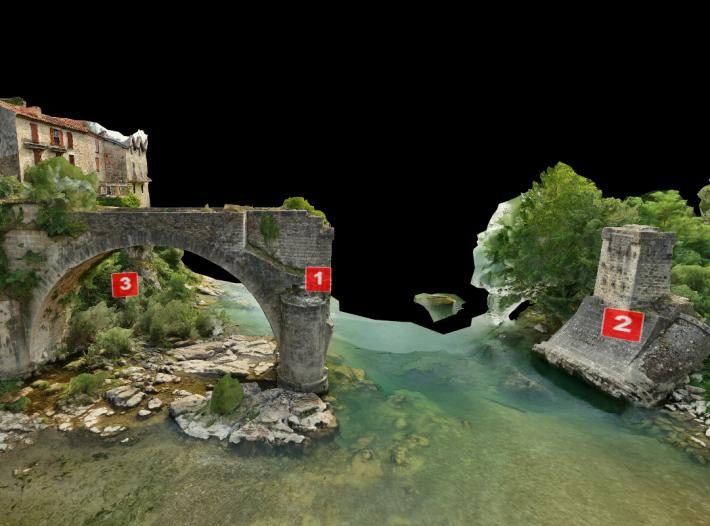
Pont Cassé bridge
Exterior 3D survey of a bridge in a natural site, annotated points of interest.
View in 3D -
-
FAQ
Your questions.
What is the difference between photogrammetry and lidar?
Lidar measures distances with a laser; photogrammetry computes geometry from photos. See our detailed comparison photogrammetry or laser scanner.
How many photos does a survey need?
From a few hundred for a small building to several thousand for a complex building or a village. The number depends on the area, the target level of detail and the required overlap.
Does the weather matter?
Yes: flying is impossible in strong wind or rain, and even lighting gives the best results. We schedule the survey accordingly, which may shift the date by a few days.
Can you fly anywhere?
No: some areas are restricted (airfields, sensitive sites, built-up areas). We check the airspace and complete the necessary formalities before each mission.
Our services
Find out more.
-
Building 3D survey
As-built plans, sections, facades and point clouds for architects and engineering firms.
Read -
Photogrammetry or laser scanner
Accuracy, texture, roofs, cost: a comparison to pick the right technique.
Read -
Heritage survey
Churches, castles and monuments: existing-condition surveys, archiving and presentation.
Read -
Drone topographic survey
Orthophotos, DSM, DTM, contour lines and volumes over large areas.
Read -
3D survey pricing
Base rates, what changes the price and worked examples.
Read
Contact
A site to survey? Let's talk about your project.
Describe your needs, with or without an estimate: we will get back to you quickly with a tailored proposal and a detailed quote.