
As-built survey · Building 3D scan
Building 3D survey: your existing building measured to the centimetre.
Facades, roofs, interiors on every level: Visuoz surveys your building in 3D by drone and photogrammetry and delivers a point cloud, plans, sections and elevations ready for CAD.
Why an as-built 3D survey?
Before a refurbishment, an extension, a change of use or a restoration, every project starts with a reliable as-built survey. A manual survey with a laser distance meter is slow, leaves areas out of reach (roofs, high facades, attics) and only records the dimensions someone thought of taking.
A building 3D survey by photogrammetry records the whole structure instead. The model stays available throughout the project: a forgotten dimension can be measured later, from the office, without going back on site.
What we survey
- Facades and gables, including upper parts, without cherry pickers or scaffolding
- Roofs, coverings and chimneys, surveyed by drone
- Interiors on every level, captured on the ground with a full-frame camera
- Entire buildings, houses, public buildings, religious buildings, commercial premises
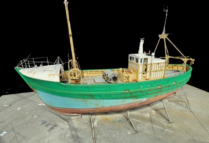
- Unusual structures: ships, bridges, large objects
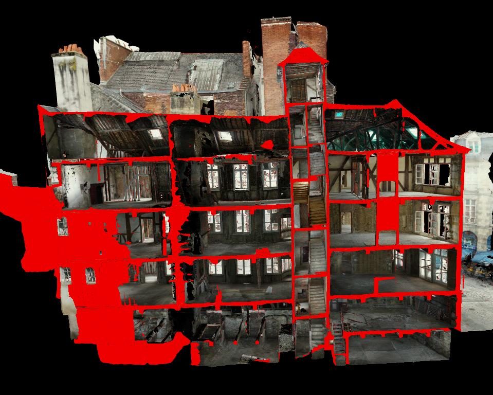
Interior and exterior are merged into a single georeferenced model: sections cut through the building and show the actual thickness of walls and floors.
Deliverables designed for architects and engineers
The architectural survey is delivered in the formats of your usual tools (AutoCAD, ArchiCAD, Revit, CloudCompare, ReCap):
- Dense point cloud in LAS / LAZ, E57 or PLY, for modelling
- Plans, sections and elevations in DXF, DWG or PDF
- Scaled facade ortho-images for drawing and condition surveys
- Textured 3D mesh (OBJ, FBX, glTF) and area measurements
- Accuracy report showing the residuals measured on control points
Every survey is also published in the Visuoz viewer: your teams and partners take measurements and cut sections in the browser from a simple link.
How does a building survey work?
1. Preparation: review of your specifications, airspace and flight permission checks, choice of coordinate system.
2. Capture: a few hours on site for a typical building; control points measured with RTK GNSS, drone flights and ground photography.
3. Processing: photogrammetric computation, georeferencing and accuracy check on independent points.
4. Delivery: in about two weeks, in the viewer and in the requested formats.
3D scan or photogrammetric survey?
A building 3D scan usually refers to a laser scanner survey. Photogrammetry produces the same kind of deliverable — a measurable point cloud — with richer photographic texture and easy access to roofs thanks to the drone. To find out which technique suits your project, read our comparison photogrammetry or laser scanner.
Projects
Selected projects.
-
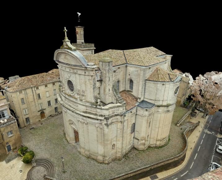
Saint-Étienne Church
Indoor and outdoor 3D survey, 0.5 m contour lines, vector views for DXF extraction.
View in 3D -
Building, 22 place Sainte-Anne
3D survey of an entire building, all levels, vertical and horizontal sections.
View in 3D -
150 roofs — Nantes Métropole Habitat
Public contract: 3D survey of 150 roofs and automatically generated PDF inspection reports.
Confidential deliverables -
FAQ
Your questions.
How accurate is a building 3D survey?
With control points measured by RTK GNSS, accuracy is 1 to 3 cm. It is documented in the accuracy report delivered with the survey.
Does the building need to be vacated during the survey?
No. Capture takes a few hours for a typical building and involves no contact with the structure. For interiors, we agree on a time slot when the rooms are accessible.
Can the point cloud be opened in Revit or ArchiCAD?
Yes. The point cloud is delivered in E57 or LAS, formats read by Revit (through ReCap), ArchiCAD, AutoCAD and CloudCompare.
How much does a building 3D survey cost?
The price depends on the area, the parts surveyed (exterior, interior or both), the level of detail and the distance. See our 3D survey pricing page for details.
Our services
Find out more.
-
Drone photogrammetry
Definition, accuracy, regulations and deliverables of a drone photogrammetry survey.
Read -
Photogrammetry or laser scanner
Accuracy, texture, roofs, cost: a comparison to pick the right technique.
Read -
Heritage survey
Churches, castles and monuments: existing-condition surveys, archiving and presentation.
Read -
Drone topographic survey
Orthophotos, DSM, DTM, contour lines and volumes over large areas.
Read -
3D survey pricing
Base rates, what changes the price and worked examples.
Read
Contact
A site to survey? Let's talk about your project.
Describe your needs, with or without an estimate: we will get back to you quickly with a tailored proposal and a detailed quote.