
Comparison · Laser 3D scan · Photogrammetry
Photogrammetry or laser scanner: which technique for your 3D survey?
Both techniques produce a measurable point cloud. They differ in principle, texture, access to upper parts and cost. Here is how to choose.
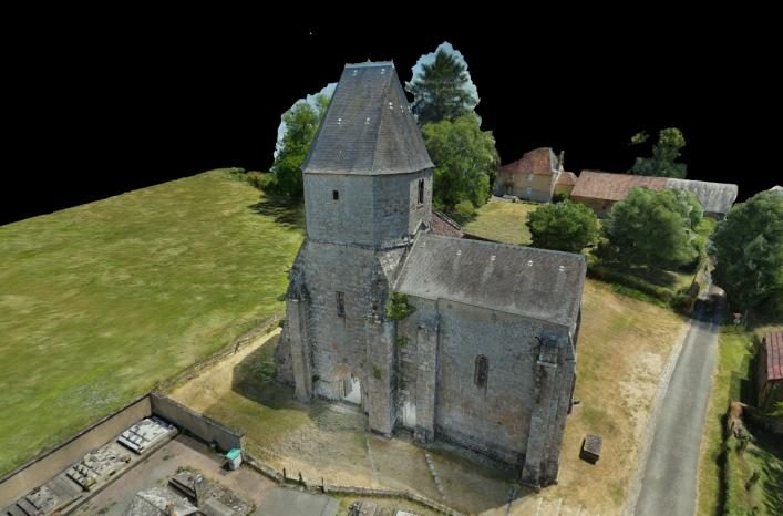
Two different principles
A 3D laser scanner (or lidar) emits a laser beam and measures the time or phase of its return: it obtains the distance of each point directly, then merges successive stations into a point cloud. Photogrammetry computes geometry from photographs taken from many angles, on the ground and from a drone.
In both cases, the result is a georeferenced point cloud, usable in the same software (Revit, ArchiCAD, AutoCAD, CloudCompare) and in the same formats (E57, LAS).
The comparison
| Criterion | Photogrammetry (drone + ground) | Terrestrial laser scanner |
|---|---|---|
| Typical accuracy | 1 to 3 cm with RTK GNSS control points | Millimetre to centimetre depending on the device and registration |
| Texture | Photographic, high resolution | Colours often less detailed |
| Roofs and upper parts | Easily covered by drone | Blind spots without a lift or elevated station |
| Large areas | Well suited: automated flights | Many stations required |
| Dark rooms, uniform surfaces | Harder: needs light and texture | Little affected by lighting |
| Orthophotos and ortho-images | A natural output of the process | Possible, with lower visual quality |
| Cost | Generally more affordable | Higher (equipment, station time) |
When to choose photogrammetry
- Heritage, churches, castles: photographic texture serves both condition surveys and public presentation
- Roofs, high facades, bell towers, cliff sites
- Land, villages, quarries: orthophotos, DTM and contour lines
- Surveys where 1 to 3 cm accuracy is enough, i.e. the vast majority of architectural and topographic studies
When a laser scanner is still the better choice
- Millimetre accuracy required (industry, mechanical engineering, deformation monitoring)
- Dark or very cluttered plant rooms, ducts, networks
- Smooth, uniform surfaces with no texture usable by photography
The two techniques can also be combined: a photogrammetric cloud covering roofs and exteriors can be merged with an interior laser cloud in the same coordinate system.
Our approach
Visuoz carries out its surveys by photogrammetry, by drone and on the ground. If your project is better suited to a laser scanner, we discuss it as soon as we review your request. For buildings, see our building 3D survey page; for the method, see drone photogrammetry.
Projects
Selected projects.
-
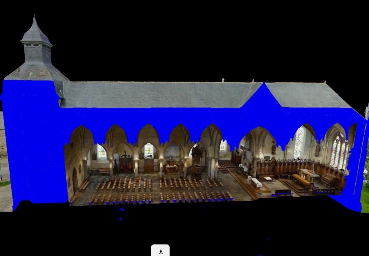
Saint-Pierre-Saint-Paul Church
Indoor and outdoor 3D survey, longitudinal section, 3D topographic view.
View in 3D -
FAQ
Your questions.
Is a photogrammetric survey less accurate than a laser scan?
It is generally less accurate than a high-end laser scanner, but reaches 1 to 3 cm with RTK GNSS control points, which is enough for plans, sections, elevations and typical topographic studies.
Can photogrammetry deliver an E57 point cloud?
Yes. The photogrammetric point cloud is delivered in E57, LAS / LAZ or PLY, just like a laser scanner cloud.
Can both techniques be combined?
Yes. Both clouds, tied to the same coordinate system, can be merged in point cloud processing software.
Our services
Find out more.
-
Building 3D survey
As-built plans, sections, facades and point clouds for architects and engineering firms.
Read -
Drone photogrammetry
Definition, accuracy, regulations and deliverables of a drone photogrammetry survey.
Read -
Heritage survey
Churches, castles and monuments: existing-condition surveys, archiving and presentation.
Read -
Drone topographic survey
Orthophotos, DSM, DTM, contour lines and volumes over large areas.
Read -
3D survey pricing
Base rates, what changes the price and worked examples.
Read
Contact
A site to survey? Let's talk about your project.
Describe your needs, with or without an estimate: we will get back to you quickly with a tailored proposal and a detailed quote.